Dec 17, 2017
1 - The LaHave River
Banner image : Evening falls along the LaHave (c) Paul X Newton Photography
About the River
For thousands of years, the LaHave River Valley has been a transportation corridor, a source of food and a place to work and play. We will look at a tiny slice of time, the 150 years that Canada has been a country.
When you are standing along the shore of the LaHave in Bridgewater, consider:
- the water flowing by you started about 92 kilometres north of town
- she was fed by 113 lakes
- the river consists of 5 tributaries - the West Branch, the North Branch, the Main Branch, the Ohio River and the North River
- she passes thru two lakes -- New Germany and Wentzell
- she collects water from an area 122 times the size the Town of Bridgewater
A bit of History
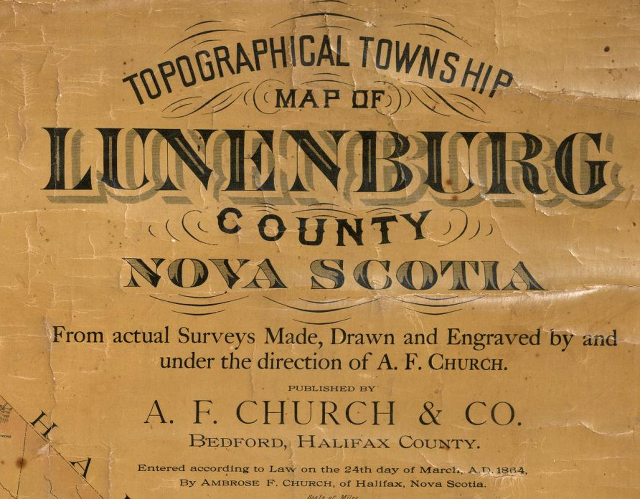
We have a very good record of activity along the LaHave River around the time of Confederation. The following three maps are from Topographical Township Map of Lunenburg County A.F. Church & Co. 1864.
Viewing Notes :
- the blue represents portions of the LaHave River Watershed.
- if you click on the map, it will be enlarged. Select 'hi-res' in the upper left corner for a better quality image.
- there is *a lot* of detail on these maps!
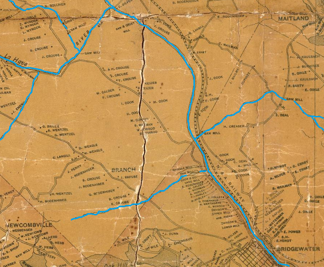
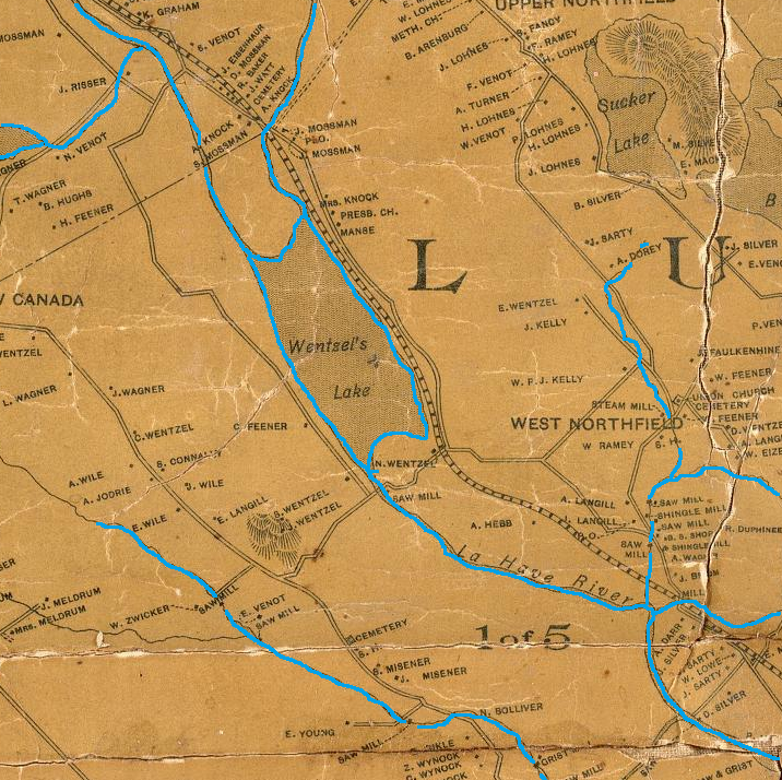
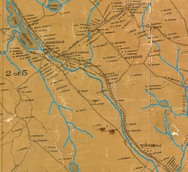
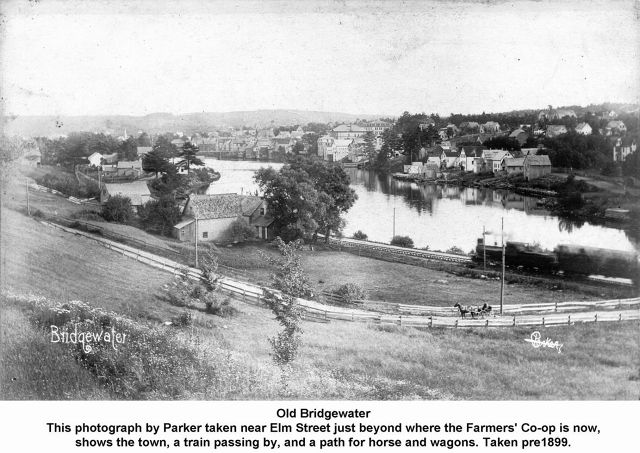
Did you notice all the activity along the River? Grist, Saw and Shingle Mills? Our ancestors were busy people!
Some of the names look familiar?? But spelled differently like "Venot' and 'Wentzel'.
What is Riverdale, Rosedale and the N&A Railway??? Philip Spencer writes ... It was the Nictaux and Atlantic Railway, the proposed name for that line from Bridgewater to Middleton. That path had been under discussion for many years so it seems Church included it in the map as it was much discussed and highly anticipated. When complete, the N & A name was not used and was originally called the Nova Scotia Central Railway and soon after was absorbed by the Halifax and South Western.)
And the map is dated 1864 but the train didn't run through Pinehurst (Riverdale) until 1888???? (Started in 1864, Church had money problems and the map wasn't published until the 1880s.)
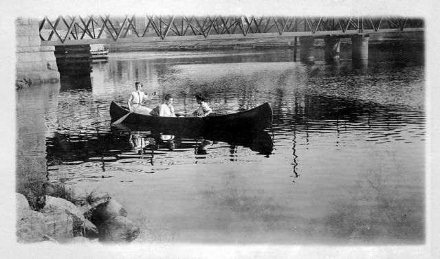
Your favourite activity on the LaHave?
In our final post of week #1, we asked readers to share their favourite activities along the LaHave.
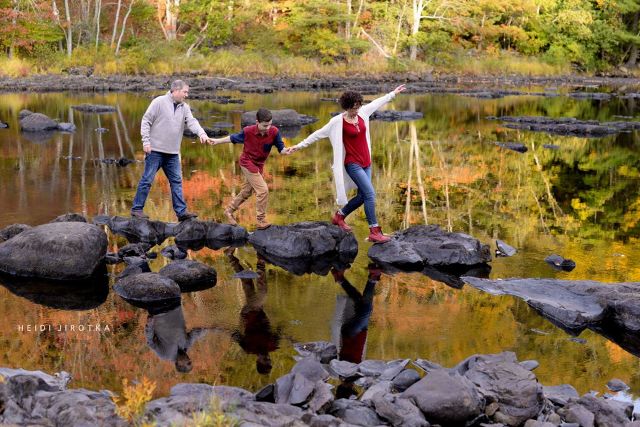
VIEWING NOTE : To see the beautiful detail in Heidi's photo above, click on the image and then select 'hi-res' in the upper left corner. It's stunning :-)
Anthony Larkin wrote ... Family cornboils were always enjoyed amongst the majestic pine trees !
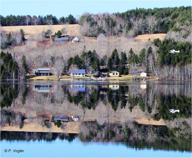
Cory Lohnes wrote ...The beauty of flying over the Lahave in the fall (and Cory included a beautiful photo from one of his recent flights)
And the everything old is new again wasn't lost on Jen Worden who commented on the recent update to the Bridgewater waterfront ... Town of Bridgewater bringing the past into the present. Well done.
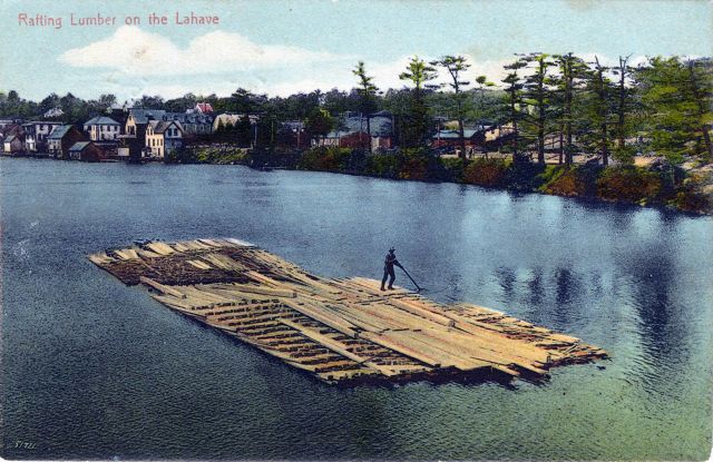
Philip Spencer writes ... Lumber rafts were built by the Davison Lumber company below the lower mill dam and this was the most practical way to get milled lumber to the loading docks downstream. This was the method E.D. Davison used to get lumber downstream since the late 1860s, mainly because the LaHave was not navigable by a vessel of any size above the bridge and the bridge was in the way. Ox carts would be too slow and even after the railway was built in 1889, it was not practical to load a railcar and take lumber down the east side to the docks, primarily because much of the lumber was stacked along the shores of the west side.
G Marcia Young Ritcey wrote ... Going to town with Mom and Dad, Gloria, Carolyn and Kent for groceries and parking along the river under the trees - great memories.
Questions ... comments ... suggestions???
Please send them through our Facebook Page or the Contact Form on our website
Created using
